Margot Kimmel, a member of the Vancouver Island Conservation Field Crew, travelled all the way from Nanaimo to the northern tip of Haida Gwaii to collect data on the Kumdis and Naden Estuaries. Read on for a full field trip report!
Field Work at Kumdis and Naden Estuaries in Haida Gwaii – September 20th – 26th, 2021
By: Margot Kimmel
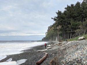
Agate Beach, Naikoon Provincial Park, Haida Gwaii
Dark rain clouds begin to form overhead as we pull up to the long-term parking lot at the small Nanaimo Airport. I am with Sonja, NTBC’s Junior Restoration Technician, and we begin hauling our gear, including a large cooler and toolbox filled with an array of supplies from dataloggers to duct tape, onto luggage carts. The looming rainclouds are giving us a taste of what the weather will be like up in the rainforests of Haida Gwaii, an archipelago known to be the wettest place in British Columbia. It is also a region rich in the culture of the Haida First Nation, a linguistically distinct group with a deep connection to the land and sea. The name Haida Gwaii literally translates to “Islands of the People.”
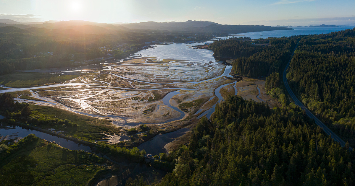
This trip is part of the Estuary Resilience Project: a five-year project working alongside Coastal First Nations to conduct monitoring of estuary resilience to sea-level rise. The data collected will be used to inform future projects focused on restoring estuarine processes and enhancing habitat for fish and wildlife. Armed with a long list of tasks to complete, our aim for the trip is to visit two estuaries—the Kumdis River estuary and the Naden-Davidson estuary complex – both on Graham Island, the northern-most landmass of Haida Gwaii.
At the Nanaimo Airport, we throw our bags onto the conveyor and find our way to the waiting area. It feels surreal to be going through the motions of airport travel after almost a year and a half of staying put due to the COVID-19 pandemic. After a quick 20-minute flight to Vancouver, we have a short layover and transfer to a smaller plane heading to Sandspit, a small and sleepy town on the northern tip of Moresby Island. In fact, it is the only town on this island, with a population of 296 residents. The plane does a big loop as it circles over the islands. I look out the window as we emerge from above the grey clouds, revealing a sea of dark green forest and then a seemingly continuous stretch of beach, frothy white waves collapsing onto the shore. We begin our descent, rain streaming across the small plane window.
While waiting for our bags at the single tiny conveyor belt, I look over at a large diorama of Haida Gwaii, attempting to spot the estuaries we will be travelling to over the next week. Kumdis is located near the old logging town of Port Clements, with the mouth at the Masset Inlet. Naden is much larger and less accessible, with no active roads leading to it. I stare at the section of open ocean we must cross via boat in order to get into the Naden Harbour, and my stomach does a little flip thinking about the high potential of a rough ride.
After collecting our bags, we are met by a friendly woman running the shuttle bus to the ferry that will take us to the village of Skidegate on Graham Island. Aboard the ferry, we stand underneath a small sheltered deck out of the rain and make out silhouettes of little rocky islands in the distance. Suddenly, a larger landmass comes into view, fishing boats bobbing in the harbour. Once we arrive on shore, we find our rental truck and begin the 1.5-hour drive to Masset.
Misty views of Moresby Island from the ferry to Skidegate
The next day is spent in the Kumdis River estuary. We meet with Hannah from the Council of the Haida Nation, as well as Peter, a contractor who helps with collecting data in between our visits. We pull on our waders and walk carefully over deep channel after channel, many of them hidden by the tall sedges, proving to be tricky and slow-going. One thing I’ve learned from fieldwork: walking in estuaries is quite the skill, especially when you are attempting to find a very hidden datalogger while also keeping your eyes down to make sure you don’t break an ankle.
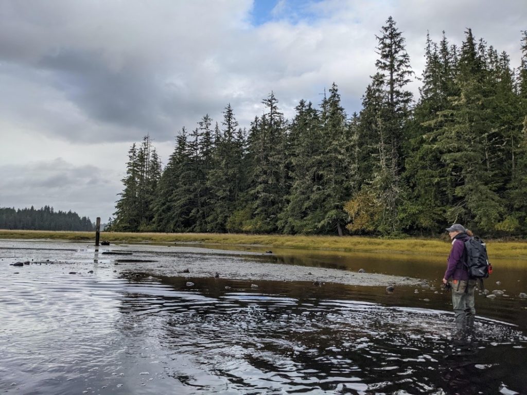
Wading in the Kumdis Estuary
When we arrive in the estuary, I notice a strange looking structure in the middle. It looks like a massive rock island with every inch covered in moss and shrubs. After a better glance, I realize it’s an old barge that had been there so long it had simply become a part of the landscape—nature taking ownership. Peter tells us that the barge has been there for likely close to 100 years, and was used to transport logs in the inlet.
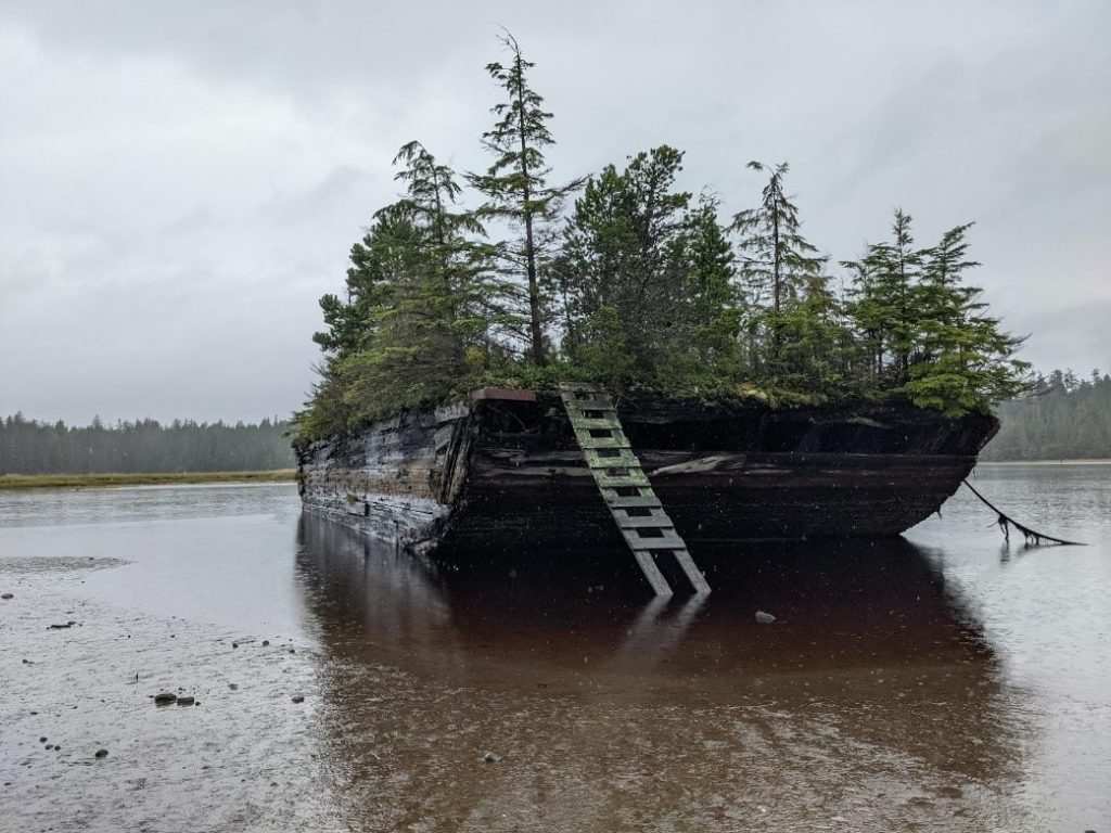
Native trees, shrubs and mosses making their home on an old barge in the Kumdis Estuary
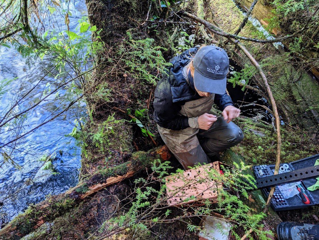
As soon as Sonja pulls out her field computer and connection cables from her backpack, the rain begins. I hold a small towel over her equipment while she bends over the makeshift shelter to plug in the datalogger and download the data. Even though all the equipment we use is technically waterproof, we try to keep the connection ports as dry as possible. We joke that we should start bringing an umbrella with us into the field. After finishing our scavenger hunt for the rest of the dataloggers and taking a sediment core, which involves hammering an 80cm-long PVC pipe into the ground using a wooden 2×6 board and then carefully digging it out using a clam shovel (very high-tech equipment here!), we make our way back across the estuary to the truck. Carefully pulling our feet through the thick estuary mud, we attempt to take steps as quickly as possible to avoid getting sucked in while also trying not to lose balance. Walking in the estuary is truly an artform.
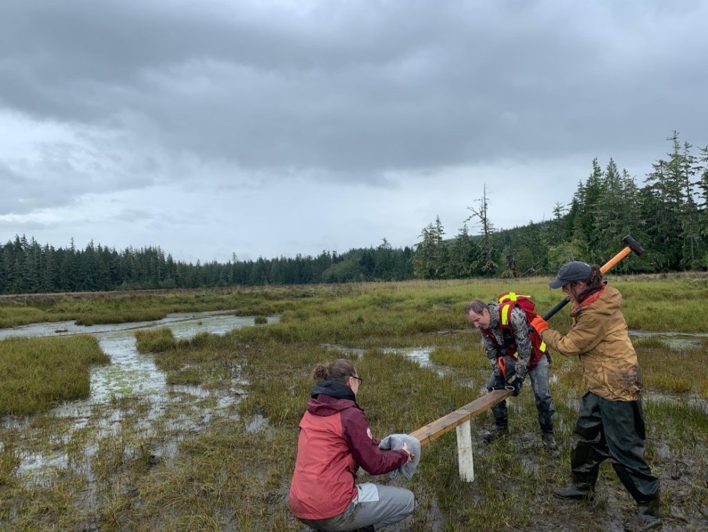
Hammering the PVC pipe into the ground to collect a sediment core
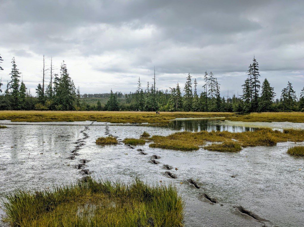
Footsteps through the thick mud at Kumdis Estuary
We drive down the road to another access point and walk through a beautiful pocket of old-growth forest filled with towering red cedar and thick Sitka spruce. Long, wispy old man’s beard lichen hang from their branches like jewelry and raindrops shimmer in the sunlight. After a full morning of grey overcast, the clouds open up to reveal bright blue sky, and the sun lights up the grasses and sedges in green and gold hues.
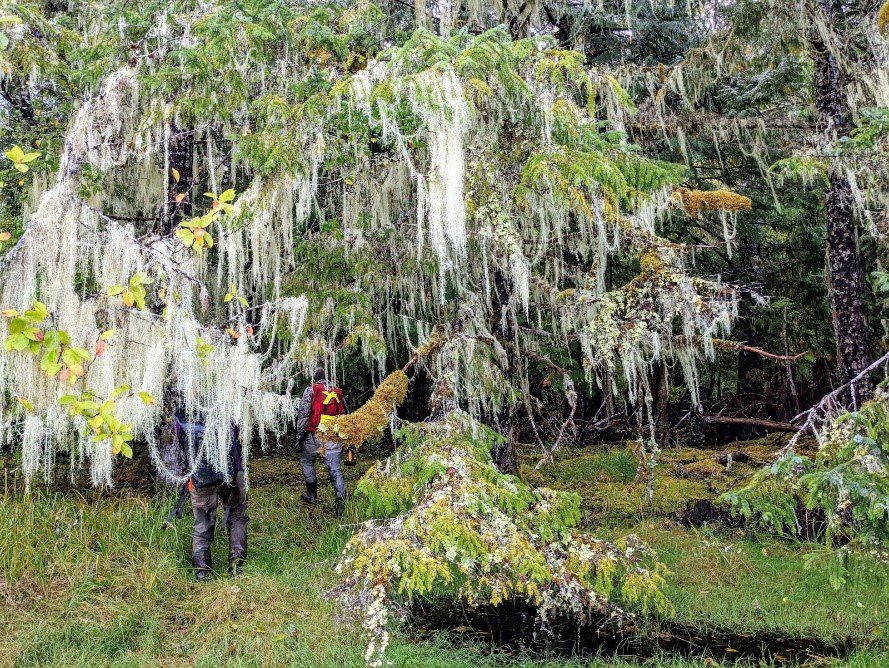
Abundant old man’s beard lichen (Usnea longissimi), hanging from the tree branches.
Sun lighting up the Kumdis Estuary
Our final task is to retrieve a turbidity logger deployed up the Kumdis River. We drive the truck as far as we can down an old road overgrown with alder, and then walk the rest of the way, bushwhacking the last 500 meters. As we walk, I notice many kinds of mushrooms popping up along the trail—a delicate cream-coloured bonnet growing from a mossy cedar branch and a snow-white angel wing hiding under a nurse log.
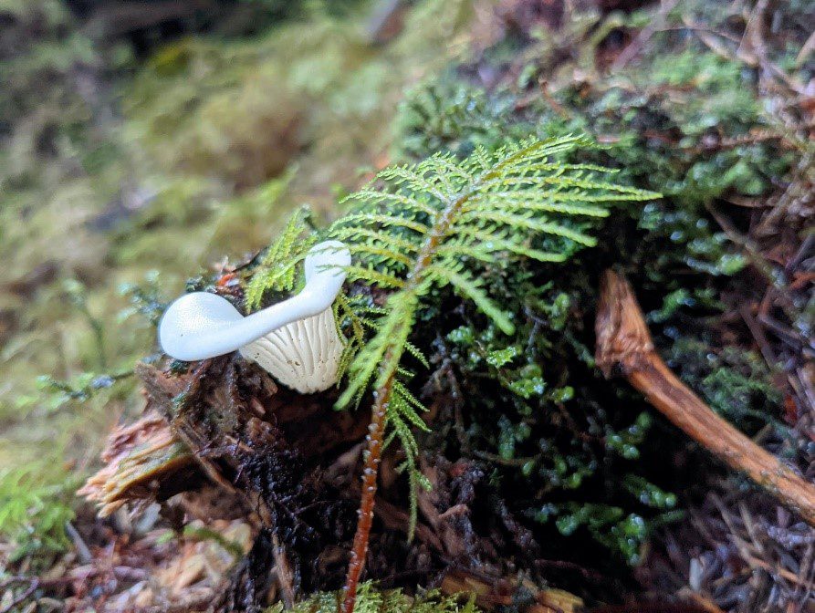
Angel wing mushroom
We find the cedar that the logger is attached to along the bank of the river. It is protected by another fallen trunk, creating a calm yet deep pool protected from debris and the strong current–a textbook location for the turbidity logger. The logger is inside a metal box with holes in it and fastened to a tele-spar post. We remove the post and open the box, revealing a black tubular casing with a small wiper arm (which keeps the sensor clean) attached to it. We collect the data and replace the batteries for the wiper arm, and then return it back to the river.
Sonja opening up the turbidity logger box
The next day we are out the door at sunrise to bring our gear to Masset Harbour, where we will board the boat taking us to the Naden Estuary. The sun is just starting to peek over the houses across the channel, a golden ball of light just on the horizon. I take a big sigh of relief–the water looks flat and calm. However, I know it could be a different story as soon as we get out to open ocean. I hear a familiar hoarse cry and look up to see a juvenile bald eagle flying overhead towards a nest in a tall Sitka spruce. We meet our captain, Barney, a kind Haida man who has been boating for decades. We begin loading our supplies onto the boat–an aluminum 25-footer with a small cabin that fits six comfortably. We also meet Taylor–a bubbly young field technician for the Council of the Haida Nation who will be assisting us and setting traps for the invasive green crabs.
All packed up, we throw on lifejackets and motor along the calm waters as the sun continues to rise behind Masset, creating soft rays of light shooting into the sky. We pass longhouses with hand-carved totem poles flanking their entrances in the Haida town of Old Masset. As soon as we leave the harbour, the swell picks up and the boat crashes over the waves, bouncing along. Barney confidently steers us through the whitecaps. I stand outside clinging to the side of the boat, keeping an eye out for seabirds and inhaling the salty air in an attempt to calm my seasickness. I spot a flock of jet-black pelagic cormorants perched on a large buoy, diving expertly into the water for fish.
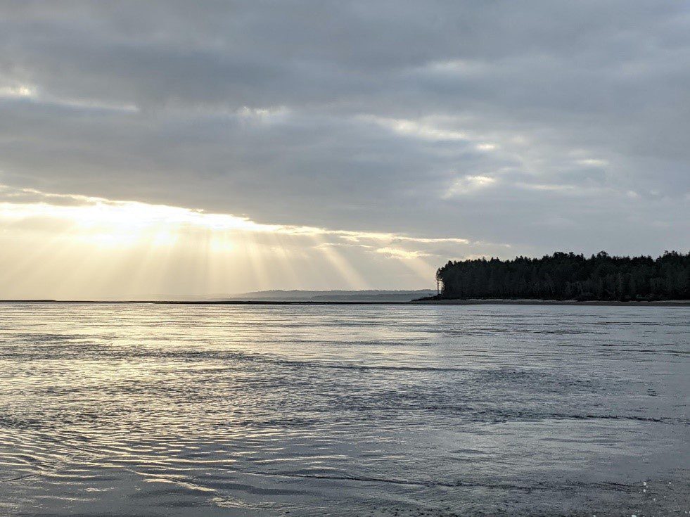
Sunrays over North Beach, Graham Island
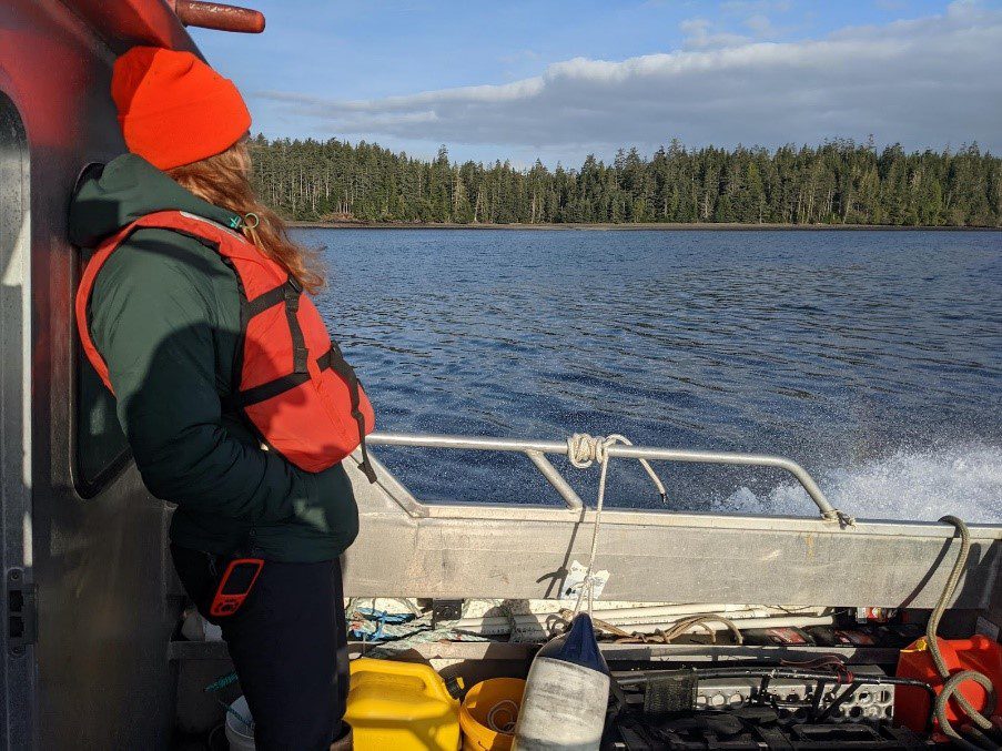
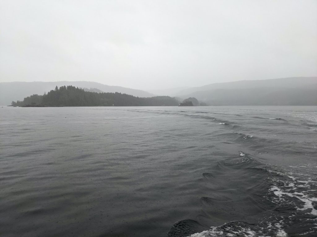
Boat ride to Naden Harbour
The next three days are wet and cold, and we spend them working hard to check off all of our tasks. As soon as we arrive and unpack our gear onto the dock, Sonja and I head back out on the boat with Barney to find and replace the marine turbidity logger. It is attached to a buoy in the middle of Naden Harbour. We find the buoy and begin the awkward and difficult task of lifting it out of the water. It is extremely heavy due to the clumps of mussels that have decided to make it their home. The logger box is attached to a long metal chain, and with both of us pulling and heaving, we manage to lift it inside the boat. We remove the box containing the turbidity logger, and replace it with a fresh one. We attach it back onto the buoy’s chain, and lower the whole setup back into the water. We will be taking the old logger and box back with us, so we carefully remove as many mussels and nudibranchs as we can, throwing them overboard, hoping they will find a new home.
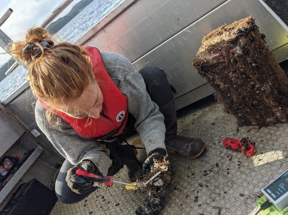
Sonja removing sea life from the marine turbidity logger
We arrive back at the dock and wait for Peter to pick us up with the truck. We drive down a logging road and then turn off onto a mossy driveway leading to a rustic little cabin by the water–our home for the next three nights. The cabin is owned by Fisheries and Oceans Canada, who have graciously allowed us to use it while working in Naden Harbour.
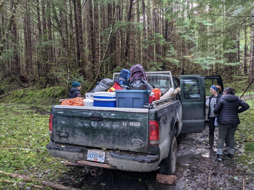
Our truck packed to the brim with gear
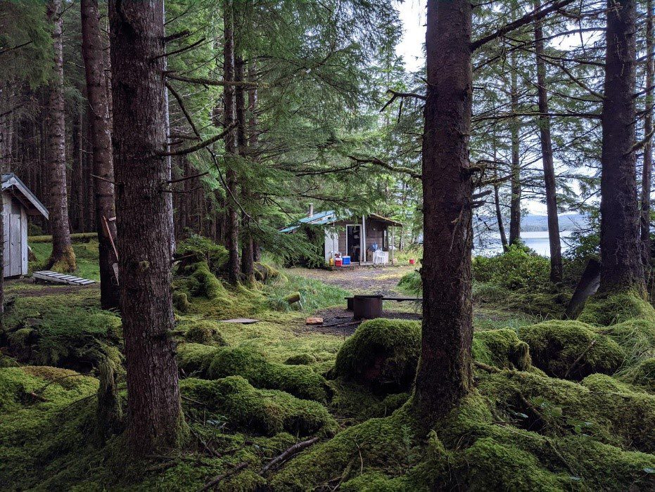
The Fisheries and Oceans Canada cabin in Naden Harbour, tucked away in the forest
Our second day in the field is when the rain really lets loose–soaking us all through, even with our heavy-duty raingear. Sonja creates a makeshift shelter by hiding under her small towel so that she can use the touchscreen to input data, while Peter and I take measurements to record short-term sediment accretion.
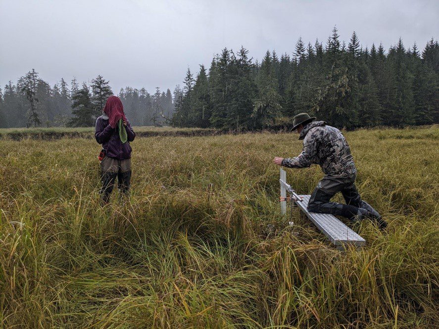
Sonja inputting data and Peter taking sediment measurements
On the final day, we drive out to the bridge crossing the Davidson River, and we can’t believe our eyes. All that rain from the day before had caused the river to flood immensely. Areas where we were standing just a day before were underwater. We look across the bank and are shocked to see that one of the abutments for the bridge had been ripped straight out of the side of the riverbank and the washout has taken a few trees with it. Peter reckoned that the bridge was at least 60 years old, so it is quite possible that we had just experienced a 100-year rain event.
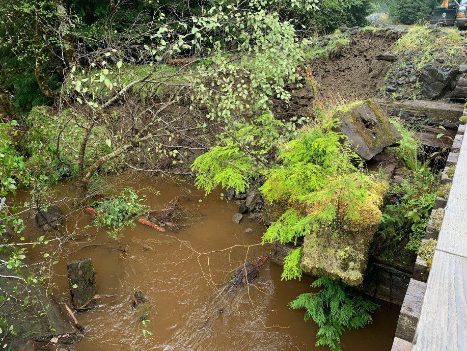
Flooding and erosion of the riverbank caused by the rain event
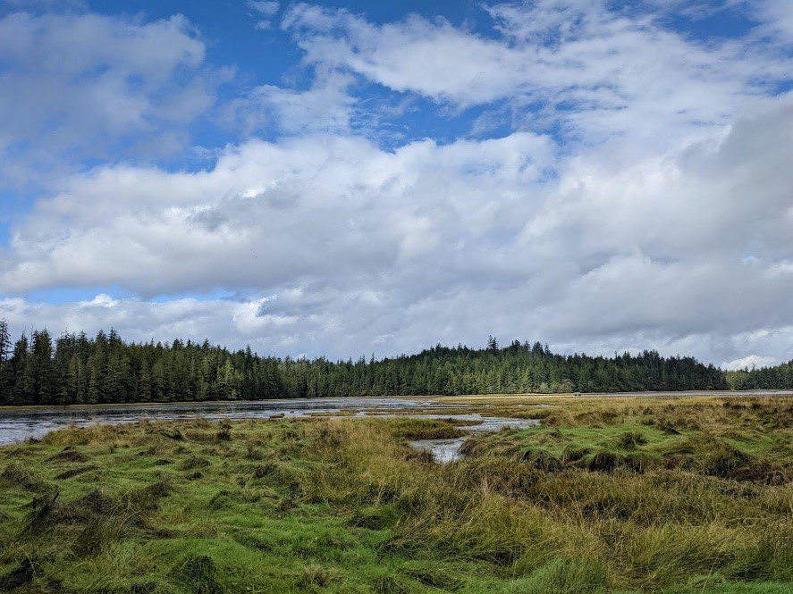
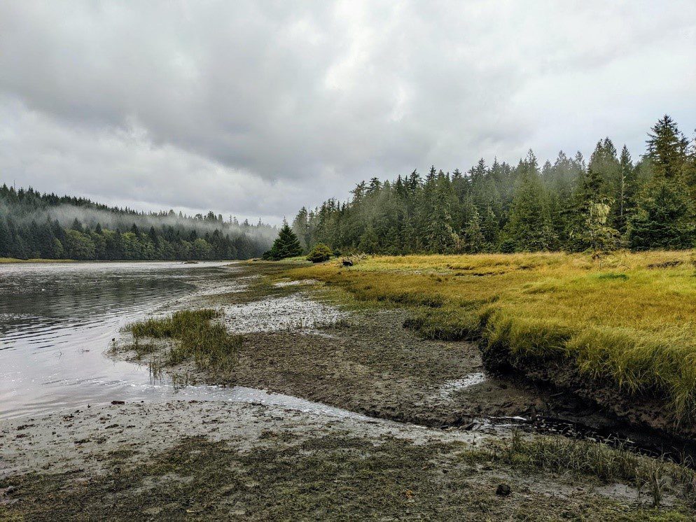
We drive slowly across the bridge to reach our final spot, hoping the bridge won’t crumble under us now that an important piece of the structure is gone. We park on the side of the road and bushwhack through a forest full of spongy sphagnum moss and pools of water; the rain had created bog-like conditions. I am happily surprised to come across bog cranberries–proof that these wet conditions are maybe more common than I thought. We emerge from the forest to the mouth of the estuary – the first time we are seeing it since arriving. A low-hanging mist lines the channels, and expanses of golden sedge are interrupted with muddy sections and the occasional driftwood stump.
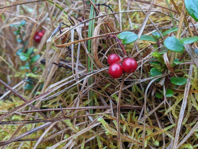
Bog cranberries (Vaccinium oxycoccos)
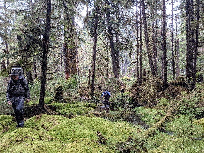
Bushwhacking through the boggy forest filled with sphagnum moss
Fog hanging in the trees at the Naden Estuary
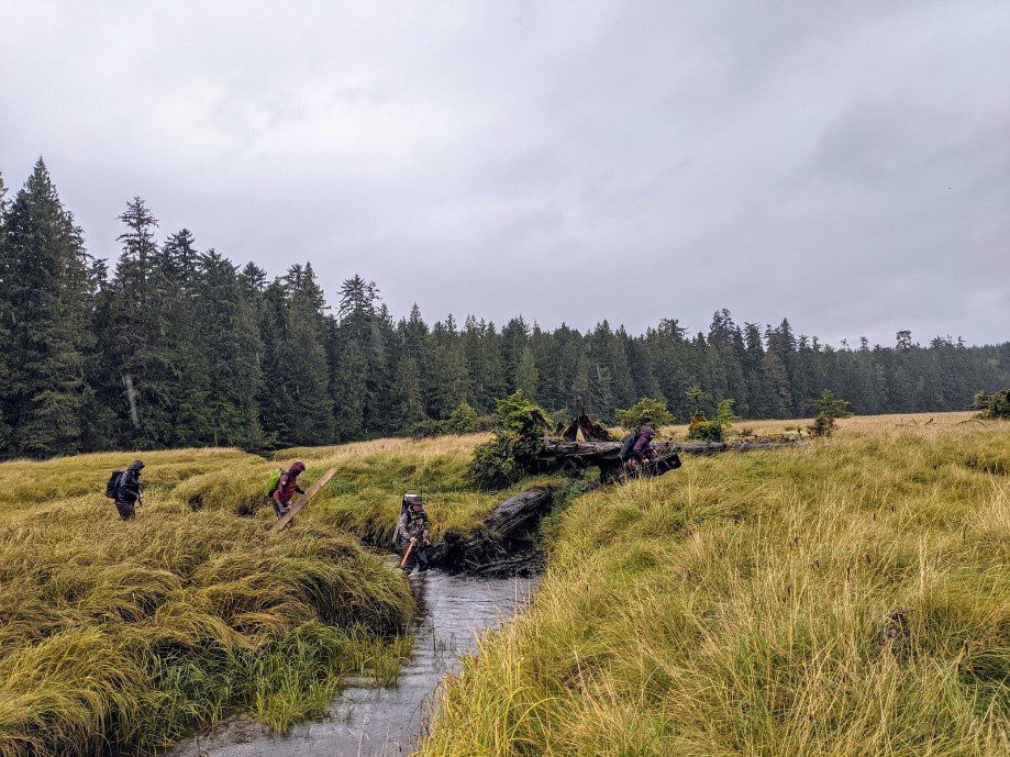
Wading across one of the many small channels within the Naden Estuary
On our final evening back at the cabin, we attempt to dry out our gear; we cram everything into the kitchen and light a big fire in the woodstove, hoping that will do that trick. We extrude the sediment cores while we wait.
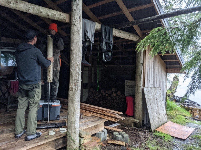
Extruding the sediment core sample which is cut into 2 cm thick slices and stored in a cooler for transport back to Vancouver Island
The next day is sunny and warm, and we meet Barney at the dock to load the boat before heading back to Masset. The water reflects the puffy white clouds like a mirror. The boat ride back is smooth and calm, and as I watch the dark blue water flow by, I feel gratitude for the beautifully rich ecosystems I experienced this past week as a visitor to this land of the Haida. This land, which has seen thousands of years of deep interconnections, has shown me all of the cycles working continuously as one. I think about the Haida belief that everything is connected–land, sea and people–and I can’t help but feel this truth to my core.
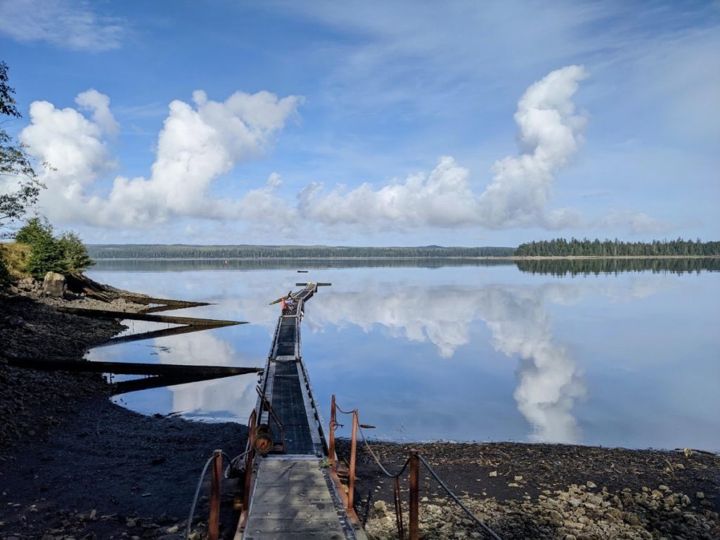
Mirror-like reflections at the dock before our boat ride back to Masset